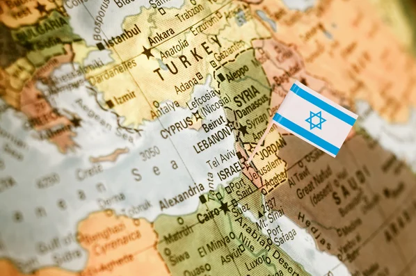
Israel, nestled in the Middle East, boasts a diverse geography that encompasses four distinct regions.
The Coastal Plain along the Mediterranean coastline is fertile and densely populated, housing major cities like Tel Aviv and Haifa. Moving inland, the fertile Jezreel Valley and Galilee region offer lush landscapes and historical significance. To the south, the Negev Desert dominates, characterized by its arid expanses and unique ecosystems.
The Jordan Rift Valley, including the Dead Sea, forms the eastern border, showcasing the lowest point on Earth.This varied terrain not only shapes Israel's landscape but also influences its climate, culture, and history, making it a fascinating subject of exploration on the Israel map.
Israel's map is adorned with a constellation of dynamic cities, each contributing uniquely to the country's cultural and economic landscape.
Tel Aviv, known as the "City that Never Sleeps," pulsates with modernity, boasting a vibrant nightlife, cutting-edge technology scene, and stunning Mediterranean beaches.
Jerusalem, Israel's capital, stands as a symbol of religious and historical significance, with its Old City housing sacred sites revered by Jews, Christians, and Muslims alike.
Haifa, nestled on the slopes of Mount Carmel, is renowned for its blend of industry and natural beauty, including the breathtaking Baha'i Gardens. From Beersheba in the Negev to Eilat on the Red Sea, each city on the Israel map tells a unique story of resilience, innovation, and cultural diversity.
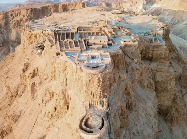
Israel's map is a tapestry of ancient history, adorned with landmarks that bear witness to millennia of human civilization. Explore Masada, a UNESCO World Heritage Site and symbol of Jewish resistance, perched majestically atop a desert plateau overlooking the Dead Sea. Wander through the Roman ruins of Caesarea, once a bustling port city built by King Herod the Great. Delve into the ancient city of Beersheba, with its well-preserved remnants dating back to biblical times.
From the Crusader fortress of Acre to the archaeological wonders of Megiddo, the Israel map invites you to uncover the layers of history that have shaped this land and its people over centuries.
Israel's map is dotted with cultural gems that reflect the country's rich tapestry of heritage and innovation. Explore the mystical city of Safed, renowned for its vibrant art scene and spiritual atmosphere, where centuries-old synagogues and galleries intertwine in a labyrinth of cobblestone streets. Indulge your senses at Carmel Market in Tel Aviv, a bustling bazaar overflowing with fresh produce, spices, and eclectic street food.
Dive into the pulsating nightlife of Tel Aviv, a melting pot of music, theater, and culinary delights. From the ancient port of Jaffa to the contemporary galleries of Tel Aviv, the Israel map offers a kaleidoscope of cultural experiences waiting to be discovered.
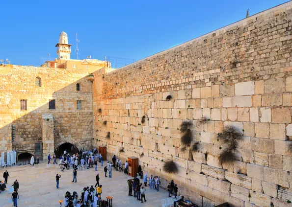
The Israel map is a sacred landscape, cradling sites of profound religious significance revered by millions worldwide. Explore the Western Wall in Jerusalem, the last remnant of the ancient Jewish Temple and a place of pilgrimage and prayer for Jews from around the globe. Stand in awe at the Church of the Holy Sepulchre, believed to be the site of Jesus Christ's crucifixion, burial, and resurrection.
Visit the Dome of the Rock, an iconic symbol of Islam, which sits atop the Temple Mount in Jerusalem. From the serene shores of the Sea of Galilee to the tranquil gardens of the Mount of Olives, the Israel map is a testament to the enduring power of faith and devotion.
Beyond its historical and cultural treasures, Israel's map unveils a tapestry of natural wonders that captivate the imagination. Behold the ethereal beauty of the Dead Sea, a hypersaline lake nestled in the Judean Desert, renowned for its buoyant waters and mineral-rich mud. Explore the dramatic landscapes of the Ramon Crater, a geological marvel formed over millions of years by erosion and tectonic activity.
Wander through the enchanting oasis of Ein Gedi, where lush vegetation thrives amid the arid wilderness of the Judean Desert. From the snow-capped peaks of Mount Hermon to the coral reefs of the Red Sea, Israel's map is a treasure trove of natural splendor waiting to be explored.
The Israel map is not only a testament to the country's rich history and cultural diversity but also a reflection of its complex geopolitical landscape. Explore the internationally recognized borders of Israel, including its boundaries with Lebanon, Syria, Jordan, and Egypt. Delve into areas of dispute such as the West Bank, Gaza Strip, and Golan Heights, each presenting unique challenges and opportunities for peace and reconciliation.
Gain insights into the ongoing negotiations and conflicts surrounding these territories, which have profound implications for the future of the region. From the Green Line to the Separation Barrier, the Israel map offers a nuanced perspective on the complexities of the Israeli-Palestinian conflict.
Israel's map is peppered with an array of tourist hotspots, beckoning travelers with promises of adventure, history, and cultural immersion. Discover the ancient fortress of Masada, where the remnants of King Herod's palace overlook the stark beauty of the Judean Desert. Explore the vibrant streets of Tel Aviv, where modern skyscrapers stand in juxtaposition to historic neighborhoods brimming with charm and character.
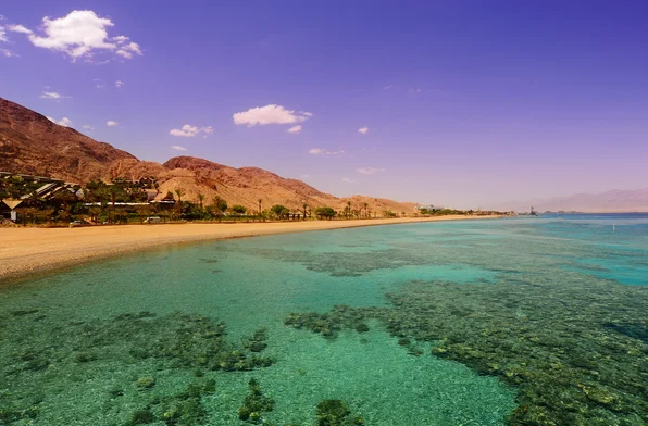
Relax on the pristine beaches of Eilat, nestled on the shores of the Red Sea, or immerse yourself in the timeless beauty of the Galilee region, dotted with picturesque villages and rolling hills. Whether you're drawn to ancient history, culinary delights, or natural beauty, the Israel map offers a treasure trove of experiences waiting to be uncovered.
Navigating Israel's map is made seamless by its robust transportation infrastructure, which connects cities, towns, and regions with efficiency and ease. Explore the extensive network of highways crisscrossing the country, providing swift access to urban centers, archaeological sites, and natural attractions. Ride the modern rail system, which links major cities like Tel Aviv, Jerusalem, and Haifa, offering passengers comfort and convenience.
Discover the convenience of public transportation in metropolitan areas, including buses, trams, and commuter trains, which ensure connectivity and accessibility for residents and visitors alike. Whether you're traveling by road, rail, or air, the Israel map boasts a comprehensive transportation network that enhances mobility and facilitates exploration across the country.
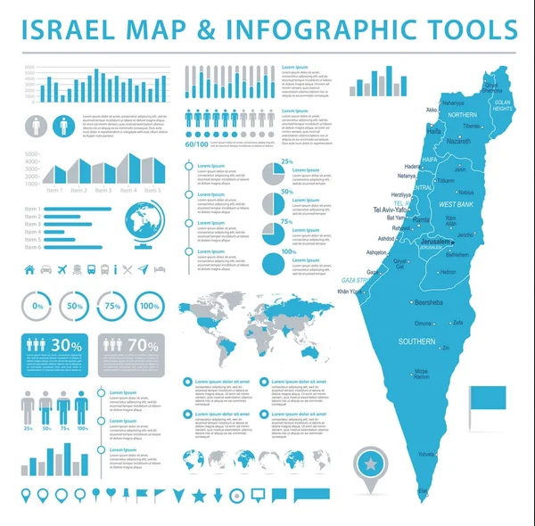
The Israel map shows a narrow strip of land bordered by the Mediterranean Sea and neighboring countries.
Major cities include Tel Aviv, Jerusalem, Haifa, Beersheba, Eilat, and Netanya.
Online sources like government websites and map service providers offer detailed Israel maps.
Coastal plains, mountains, desert, and the Jordan Rift Valley are featured.
Yes, landmarks like Masada, Caesarea, and the Old City of Jerusalem are marked.
Religious sites are usually marked with symbols or labels.
Tourist spots include Masada, the Dead Sea, Tel Aviv beaches, and the Galilee region.
Transportation routes, such as highways and railways, are marked for planning journeys.
International borders and territories like the West Bank and Golan Heights are shown.
Yes, trails and reserves like Ein Gedi and Ramon Crater are highlighted for outdoor enthusiasts.